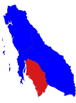
Thayetchaung Township
Appearance
Thayetchaung Township | |
|---|---|
 Location in Dawei district | |
| Coordinates: 13°41′N 98°26′E / 13.683°N 98.433°E | |
| Country | |
| Region | Taninthayi Region |
| District | Dawei District |
| Capital | Thayetchaung |
| Time zone | UTC+6.30 (MST) |
Thayetchaung Township (Burmese: သရက်ချောင်းမြို့နယ်) is a township of Dawei District in the Taninthayi Division of Burma (Myanmar). The principal town is Thayetchaung.
Subdivisions
[edit]Thayetchaung Township is composed of 39 rural tracts, and one urban tract, Thayetchaung. The rural tracts are:[1]
|
|
|
|
Notes
[edit]- ^ "Thayetchaung Township, Tanintharyi, Myanmar" Archived 2011-07-22 at the Wayback Machine, Myanmar Information Management Unit (MIMU), 12 August 2010
External links
[edit]- "Thayetchaung Google Satellite Map" Maplandia World Gazetteer


